Britain may be a small island, but its scenic roads punch far above their geographic weight. Within a few hours of driving, you can pass from rolling green farmland to jagged mountain peaks, wild Atlantic coastline to ancient forests, and stone-walled villages to empty moorland that stretches to the horizon. These fifteen routes showcase the best of what British roads have to offer.
Scotland
1. North Coast 500
Distance: 516 miles | Start/End: Inverness | Time needed: 5–7 days
Britain’s answer to Route 66. The NC500 loops through the Scottish Highlands along some of the most remote and dramatic coastline in Europe. You’ll pass white sand beaches that rival the Caribbean (though the water temperature certainly doesn’t), towering sea cliffs at Duncansby Head, and the surreal lunar landscape of Knockan Crag. The single-track roads in the far northwest require patience and passing-place etiquette, but the solitude is part of the appeal. Best driven May through September when the days are longest.
2. A82 — Glasgow to Fort William
Distance: 104 miles | Time needed: Half day minimum
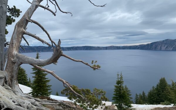
Possibly the most dramatic A-road in Britain. The A82 runs alongside Loch Lomond before climbing into Glencoe, a glacial valley so atmospheric it was used as a filming location for several James Bond and Harry Potter films. The stretch through Glen Coe itself — steep mountains rising on both sides, waterfalls streaming down rock faces — is genuinely breathtaking even by global standards. Fort William sits at the foot of Ben Nevis, Britain’s highest peak.
3. Isle of Skye Circuit
Distance: 130-mile loop | Time needed: 2–3 days
Skye is Scotland’s most photographed island, and for good reason. The Quiraing and Old Man of Storr create a landscape that looks prehistoric. Fairy Pools offer crystal-clear blue water beneath the Cuillin mountains. The road crosses dramatic sea cliffs, passes medieval castles, and winds through villages where Gaelic is still spoken daily. Summer brings midges (tiny biting insects) — bring repellent.
England
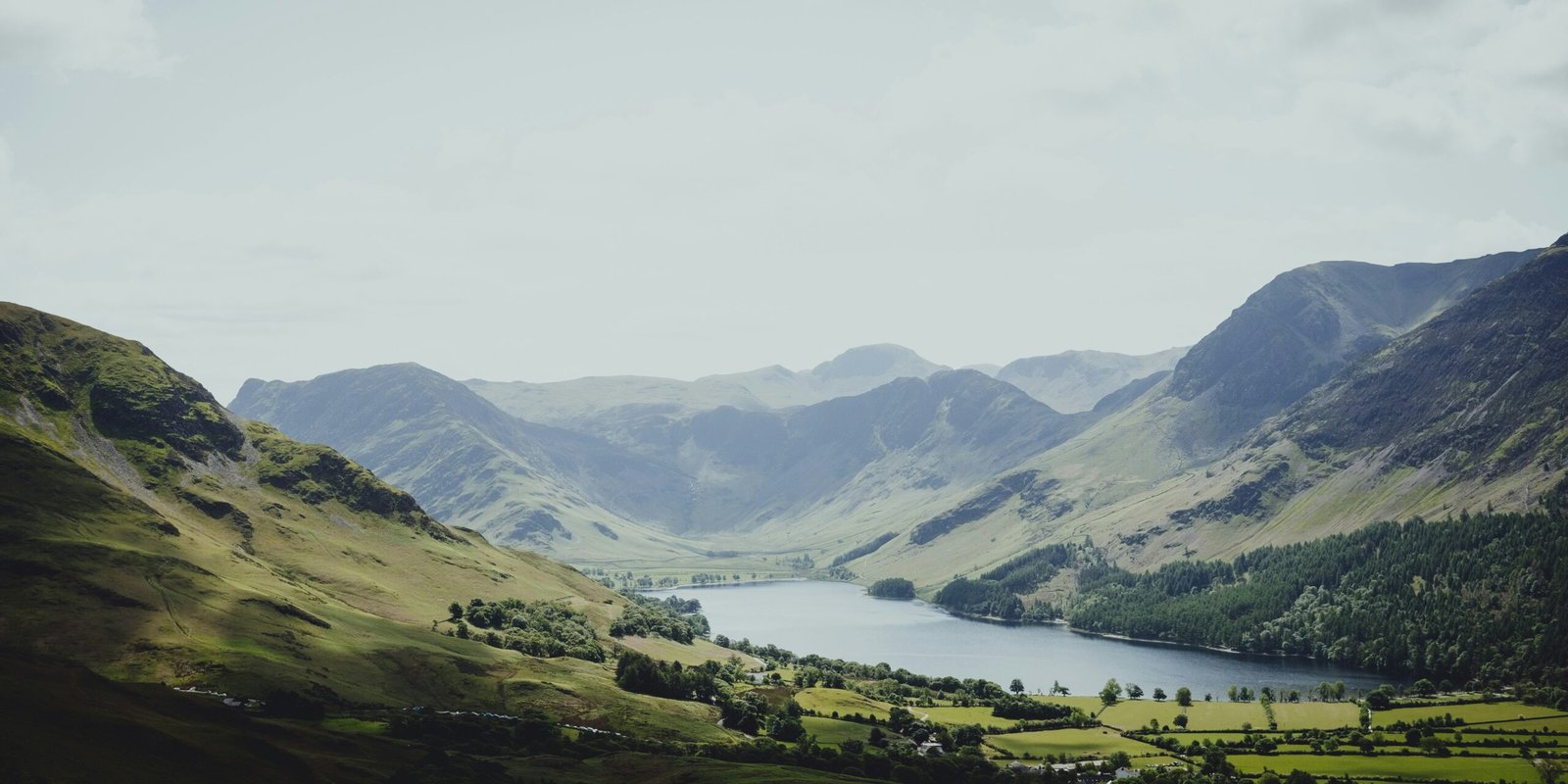
4. Lake District Loop
Distance: 80-mile loop | Time needed: Full day
A circuit through England’s most beloved national park, passing Windermere, Ambleside, the Kirkstone Pass, Ullswater, and Keswick. The narrow mountain passes are dramatic — Hardknott Pass has a 33% gradient that challenges even experienced drivers. Stop at Castlerigg Stone Circle near Keswick, one of the most atmospheric stone circles in Britain, set against a backdrop of mountains in every direction.
5. Cotswolds Scenic Drive
Distance: 90 miles | Time needed: Full day
If Scotland delivers drama, the Cotswolds deliver charm. Honey-coloured limestone villages, thatched-roof cottages, rolling green hills, and narrow lanes flanked by drystone walls — this is the England of postcards and period dramas. Bibury was once called “the most beautiful village in England” by William Morris. Bourton-on-the-Water, Stow-on-the-Wold, and Chipping Campden are all connected by quiet B-roads perfect for leisurely driving.
6. Yorkshire Dales — Buttertubs Pass
Distance: 65 miles | Time needed: Half day
The Yorkshire Dales offer some of the most open, expansive driving in England. Buttertubs Pass, a narrow road climbing between Wensleydale and Swaledale, featured in the Tour de France when the race came to Yorkshire in 2014. The views from the summit are vast — green valleys, stone barns, and sheep as far as the eye can see. Combine with a stop at the Ribblehead Viaduct, a Victorian railway bridge that’s an engineering icon.
7. Atlantic Highway — North Devon and Cornwall
Distance: 75 miles | Time needed: Full day
The A39 from Barnstaple to Newquay hugs the dramatic North Atlantic coast of Devon and Cornwall. Clovelly is a car-free village clinging to a 400-foot cliff. Bude and Tintagel (legendary birthplace of King Arthur) are windswept and wild. Surfing culture meets ancient history along this stretch, with some of Britain’s best beaches accessible from roadside parking.
Wales
8. Snowdonia Loop — A4086 and A498
Distance: 50-mile loop | Time needed: Half day
A circuit around Mount Snowdon, the highest peak in Wales. The Llanberis Pass is a narrow glacial valley with sheer rock walls popular with climbers. Pen-y-Pass sits at the top, offering views down both sides of the mountain range. The route passes through slate mining villages and past lakes of impossible blue-green colour. For extra drama, time your drive around the Snowdon Mountain Railway schedule and watch the steam train ascending the peak alongside your road.
9. Black Mountain Road (A4069)
Distance: 22 miles | Time needed: 1–2 hours
Made famous by its repeated appearances on Top Gear and other motoring shows, the A4069 through the Black Mountains in the Brecon Beacons is a driver’s road — swooping curves, open hilltop straights, and virtually no traffic. The views from the summit across the Welsh valleys are sweeping and desolate. Commonly called “the best driving road in Wales” and often compared to European mountain passes.
Cross-country routes
10. A66 — Scotch Corner to Penrith
Distance: 50 miles | Time needed: 2 hours
A dramatic trans-Pennine route crossing the backbone of England. The road climbs through Bowes Moor to the summit at Stainmore, with views across the North Pennines AONB. The descent into the Eden Valley reveals the Lake District mountains ahead. Fast-moving and exposed — spectacular in winter snow, when the moors look truly Arctic.
11. Snake Pass (A57)
Distance: 15 miles | Time needed: 45 minutes
Connecting Sheffield and Manchester through the Peak District, Snake Pass is named for its twisting course through the Dark Peak moorland. The road climbs to 1,680 feet through bleak, atmospheric terrain — dark peat bogs, exposed gritstone edges, and reservoir valleys. It closes frequently in winter due to ice and snow, which tells you something about its character.
12. A470 — Cardiff to Snowdonia
Distance: 186 miles | Time needed: Full day
Wales’s main north-south route passes through the entire country, from the capital city through the Brecon Beacons, across the green heartland of mid-Wales, and into the mountains of Snowdonia. The transition from urban to increasingly wild landscape is gradual and beautiful. Stop in the book town of Hay-on-Wye and the Victorian resort of Llandrindod Wells.
13. Causeway Coastal Route (Northern Ireland)
Distance: 120 miles | Time needed: Full day
Technically Northern Ireland rather than Great Britain, but too good to exclude. The route from Belfast to Londonderry passes the Giant’s Causeway — 40,000 interlocking basalt columns formed by ancient volcanic activity. The Carrick-a-Rede rope bridge, Dunluce Castle ruins, and the Dark Hedges (made famous by Game of Thrones) are all along this stunning coastal stretch.
14. Military Road (B3055/B3322) — Isle of Wight
Distance: 15 miles | Time needed: 1–2 hours
A short but memorable coastal drive along the southern edge of the Isle of Wight, passing the famous Needles chalk stacks and multicoloured sand cliffs at Alum Bay. The road follows the route of a Napoleonic-era military road built to defend against French invasion. Combine with the ferry crossing from Portsmouth for a complete day trip.
15. Cheddar Gorge (B3135)
Distance: 3 miles | Time needed: 30 minutes + stops
England’s largest gorge may only be three miles long, but the vertical limestone cliffs rising 450 feet on both sides make it feel like driving through a crack in the earth. The road twists through the narrow gap with several viewpoints and a famous cave system. Yes, this is where Cheddar cheese originated — the caves maintain a constant temperature perfect for aging cheese.
UK driving tips: Remember that the UK drives on the left side of the road. Petrol (gas) is sold in litres, not gallons, and costs significantly more than in the US. Many scenic routes in Scotland and Wales use single-track roads with passing places — pull into the nearest passing place on your left when meeting oncoming traffic. Speed limits are in miles per hour: 30 mph in towns, 60 mph on single carriageways, 70 mph on dual carriageways and motorways.
Frequently asked questions
Leave a Reply