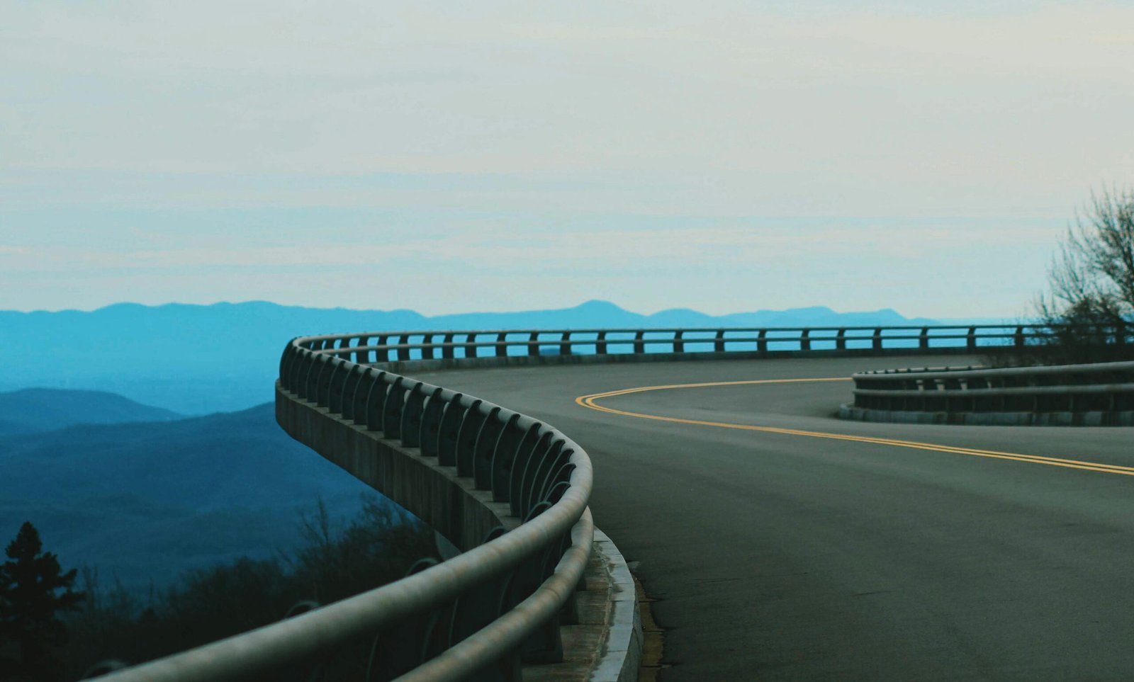
The Blue Ridge Parkway is the most visited unit in the entire National Park Service system, and this is what we observed that its more popular than Yellowstone, the Grand Canyon, or Yosemite. And unlike those parks, you experience this one from behind the wheel. Winding 469 miles through the Appalachian Mountains from Virginia’s Shenandoah Valley to the Great Smoky Mountains of North Carolina, it’s a road designed purely for the pleasure of driving.
Built during the Great Depression as a public works project, the Parkway was conceived as a “museum of the managed American countryside.” There are no commercial vehicles, no billboards, and a strict 45 mph speed limit that forces you to slow down and actually see what you’re driving through. The result is one of the most meditative driving experiences in America — rolling green mountains, misty valleys, split-rail fences, and wildflower meadows stretching in every direction.
Quick facts
469 miles (755 km)
Virginia & North Carolina
Richland Balsam, 6,053 ft
45 mph throughout
Free (no entrance fee)
Mid-October to early November
When to drive the Blue Ridge Parkway
Each season offers something different, but fall is king. The Parkway’s elevation ranges from 649 to 6,053 feet, which means fall color starts at the highest points in late September and cascades downward through mid-November. For peak foliage, aim for mid-October — the entire mountain range lights up in oranges, reds, and golds that are genuinely hard to believe until you see them in person.
Spring (April–May) brings wildflowers and rhododendron blooms. Summer (June–August) offers the fullest greenery and longest days, though weekend traffic can be heavy. Winter sees occasional closures at higher elevations due to ice, but lower sections remain open and beautifully quiet.
The best stops along the Parkway
Virginia section (Milepost 0–216)
The Parkway begins at Rockfish Gap, where it connects with Skyline Drive in Shenandoah National Park. Early highlights include Humpback Rocks (Milepost 5.8), where a short steep hike rewards you with 360-degree mountain views. The Peaks of Otter area (Milepost 86) features Sharp Top, a moderately challenging climb that’s one of the most iconic peaks on the Parkway. Mabry Mill (Milepost 176) is the most photographed spot on the entire road — a restored gristmill and blacksmith shop that looks like it hasn’t changed in 200 years.
North Carolina section (Milepost 216–469)
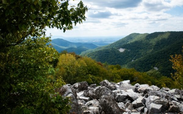
The Parkway reaches its most dramatic terrain in North Carolina. The Linn Cove Viaduct (Milepost 304) is an engineering marvel — a 1,243-foot elevated section that curves around the side of Grandfather Mountain without touching the fragile slopes. It was the last section of the Parkway to be completed, in 1983. The highest point at Richland Balsam (Milepost 431) puts you above 6,000 feet in a spruce-fir forest that feels more like Canada than the American South. The Parkway ends near Cherokee, North Carolina, at the edge of the Great Smoky Mountains.
Insider tip: The overlooks between Mileposts 350 and 420 are among the least crowded and most spectacular on the entire Parkway. Most tourists concentrate around Asheville (Milepost 382) and the northern Virginia section. Head south of Asheville for more solitude and equally stunning views.
Itinerary options
Weekend highlights (2 days)
Pick a 150-mile section and do it properly. The North Carolina stretch from Grandfather Mountain to Asheville (Mileposts 300–382) packs the most dramatic scenery into the shortest distance. Stay in Blowing Rock or Asheville.
Full Parkway drive (5–7 days)
The only way to see it all. Average 70–100 miles per day with frequent stops. Stay in small towns just off the Parkway — accommodation is not available on the road itself. Bring layers — the temperature can vary 20+ degrees between valley floors and ridge tops.
Budget breakdown
The Parkway itself is completely free to drive — no entrance fee, no tolls. Your main costs are accommodation in nearby towns, food, and gas.
| Expense | Budget | Mid-Range |
|---|---|---|
| Gas (100 mi/day at 45 mph) | $15–$20 | $15–$20 |
| Accommodation | $30–$60 (camping) | $80–$150 (B&B/hotel) |
| Food | $25–$40 | $50–$80 |
| Daily total | $70–$120 | $145–$250 |
Practical tips
Download the official NPS Blue Ridge Parkway app. It includes real-time road closure information, a milepost-by-milepost guide to overlooks and trails, and ranger program schedules. Sections close regularly for weather, maintenance, or rockslides.
Fill up before you get on. There are no gas stations on the Parkway itself. The towns of Waynesboro, Floyd, Blowing Rock, and Asheville are your best refueling points.
Watch for wildlife at dawn and dusk. Deer are extremely common and can appear on the road without warning. Black bears are also present, especially in the North Carolina section. Keep your speed moderate and stay alert, particularly in low-light conditions.
Plan for weather variability. Ridge-top fog and sudden rain are common even on days that start sunny. The higher elevations can be 15–20 degrees cooler than surrounding valleys. Pack rain gear and warm layers regardless of season.
Frequently asked questions
Leave a Reply