travelled over 600 miles along California’s rugged coastline, the Pacific Coast Highway is the drive that defines what a scenic road trip should be. Dramatic cliffs plunging into the Pacific, fog-wrapped redwood forests, sun-drenched beach towns, and some of the most photographed stretches of asphalt on the planet, PCH delivers it all in one continuous ribbon of coastal perfection.
I was told that its officially designated as California State Route 1, the Pacific Coast Highway runs from Dana Point in Orange County to Leggett in Mendocino County, though most travellers focus on the spectacular central section between Los Angeles and San Francisco. The Big Sur segment alone — roughly 90 miles of cliff-hugging road between Carmel and San Simeon — consistently ranks among the top scenic drives in the world.
Quick facts
656 miles (1,055 km)
90 miles
3–7 days
April–October
$150–$300 per person
Check Caltrans before departing
Why the Pacific Coast Highway is the world’s greatest drive
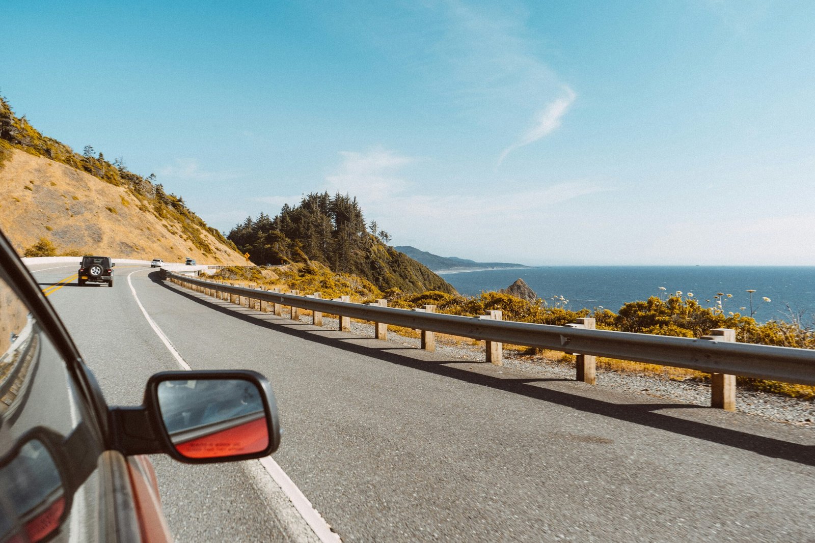
What makes PCH special isn’t any single view — it’s the relentless, mile-after-mile drama of the California coastline. One moment you’re driving through a tunnel of eucalyptus trees, the next you’re crossing the Bixby Creek Bridge with 280 feet of open air between you and the crashing surf below. The road rises and falls with the terrain, hugging sea cliffs so closely that on foggy mornings you feel like you’re driving on the edge of the world.
Unlike many scenic drives that offer distant panoramas, PCH puts you right inside the landscape. Elephant seals bask on beaches just feet from the road. Sea otters float in kelp beds visible from pullouts. Condors soar overhead in Big Sur. And the light — that famous California golden-hour light — transforms the coastline into something almost unreal at dawn and dusk.
The route: south to north or north to south?
Drive south to north if you can. Starting from Los Angeles and heading toward San Francisco keeps you on the ocean side of the road — the right lane hugs the cliff edge, giving passengers unobstructed views without the driver having to look across oncoming traffic. This direction also means the sun is behind you for most of the day rather than in your eyes. Nearly every pullout and viewpoint is on your side of the road, making spontaneous stops easy and safe.
Section-by-section breakdown
Los Angeles to Santa Barbara (100 miles)
The southern entry is gentle — a warm-up of beach towns and coastal flats. Malibu sets the tone with its celebrity-studded beaches and excellent seafood. Stop at Neptune’s Net, a legendary roadside seafood shack where bikers and surfers mingle over fried shrimp baskets. The road winds through Oxnard and Ventura before reaching Santa Barbara, where Spanish colonial architecture meets world-class wine country. The Stearns Wharf sunset is one of the best you’ll see on the entire trip.
Santa Barbara to San Simeon (150 miles)
The landscape transitions from beach towns to rolling ranchlands. San Luis Obispo offers a charming downtown and the famous Bubblegum Alley — a 70-foot lane covered in chewed gum since the 1960s. Morro Bay features the dramatic Morro Rock, a 576-foot volcanic plug at the harbor mouth. This stretch ends at San Simeon, where you can tour Hearst Castle, the absurdly opulent hilltop estate built by newspaper magnate William Randolph Hearst. The elephant seal colony at Piedras Blancas, just north of San Simeon, hosts thousands of seals year-round and is completely free to visit.
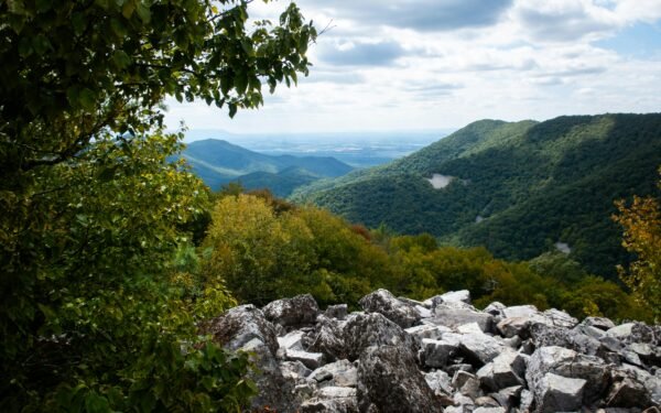
Big Sur: San Simeon to Carmel (90 miles)
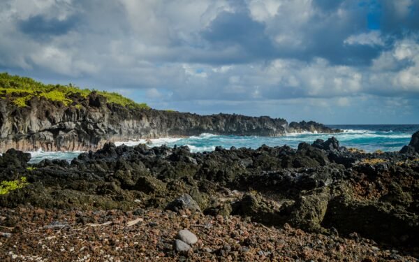
This is it — the section that appears on every “world’s best drives” list. Big Sur is not a town but a region: 90 miles of mostly undeveloped coastline where the Santa Lucia Mountains rise directly from the Pacific Ocean. There are no stoplights, few businesses, and limited cell service. What there is, in abundance, is staggering natural beauty.
Key stops include McWay Falls (an 80-foot waterfall that drops directly onto a beach), Pfeiffer Beach (with its purple sand and dramatic keyhole arch), and the Bixby Creek Bridge (one of the most photographed bridges in California). Julia Pfeiffer Burns State Park and Andrew Molera State Park offer excellent hiking trails that plunge from ridge tops down to secluded beaches.
Important: Big Sur is prone to landslides that can close the road for weeks or months. Always check the Caltrans Highway 1 status page before your trip. Road closures are common after heavy winter rains, typically from December through March. The road is most reliably open from May through November.
Carmel to San Francisco (120 miles)
Carmel-by-the-Sea is one of the most picturesque small towns in America — no street addresses, no chain restaurants, and a white sand beach backed by Monterey cypress trees. Just north, Monterey’s Cannery Row and the world-class Monterey Bay Aquarium are worth a half-day stop. The road continues through Santa Cruz, with its iconic boardwalk and surf culture, before winding through Half Moon Bay and arriving in San Francisco.
San Francisco to Leggett (optional extension, 200 miles)
North of San Francisco, PCH crosses the Golden Gate Bridge and continues through Marin County into increasingly wild, remote coastline. Point Reyes National Seashore, the Sonoma Coast, and the Mendocino headlands are spectacular but far less crowded than Big Sur. The Avenue of the Giants — a 31-mile drive through old-growth redwood groves — is one of the most awe-inspiring forest drives in America.
Itinerary options
Weekend warrior: LA to San Francisco (2-3 days)
Focus exclusively on the Big Sur section. Drive from LA to San Simeon on day one, spend day two slowly driving the Big Sur coast, arrive in San Francisco by evening. This is tight but doable if you start early.
Classic PCH road trip (5 days)
Day 1: LA to Santa Barbara. Day 2: Santa Barbara to San Simeon (with Hearst Castle). Day 3: San Simeon through Big Sur to Carmel. Day 4: Carmel, Monterey, and Santa Cruz. Day 5: Santa Cruz to San Francisco. This pace allows genuine exploration without rushing.
Full coastal immersion (7 days)
Add extra days in Big Sur for hiking, a night in Carmel, and the northern extension through Point Reyes and the redwoods. This is the version you’ll remember for the rest of your life.
Budget breakdown
California is not a cheap state, and PCH accommodation in peak season commands premium prices. Here’s what to realistically expect per person per day:
| Expense | Budget | Mid-Range |
|---|---|---|
| Gas (150 mi/day avg) | $20–$30 | $20–$30 |
| Accommodation | $40–$80 (camping/hostel) | $120–$250 (hotel/B&B) |
| Food & drinks | $30–$50 | $60–$100 |
| Activities & parking | $10–$20 | $25–$50 |
| Daily total | $100–$180 | $225–$430 |
Save money tip: Camping in Big Sur is the best way to experience it — and it’s dramatically cheaper than the few hotels in the area, which can run $400+ per night in summer. Kirk Creek Campground is right on the ocean cliffs and costs around $35 per night. Book months in advance through Recreation.gov.
Practical tips
Fill your tank before Big Sur. There’s only one gas station in the Big Sur region, at a very remote location, and prices can be double what you’d pay in town. Fill up in San Simeon heading north or Carmel heading south.
Start driving by 8 AM. The Big Sur section gets congested in summer, especially between 11 AM and 3 PM. Early morning also gives you the best light and fog conditions — the coastal fog usually burns off by mid-morning, creating dramatic photographic moments.
Pullouts are your friend. California law requires slower vehicles to use pullouts when five or more cars are behind them. Use pullouts generously for photos and to let faster traffic pass. The views from many pullouts are better than the official viewpoints.
Dress in layers. Even in summer, Big Sur mornings can be 55°F with thick fog, warming to 75°F by afternoon. The difference between the shady side of a canyon and the sunny side can be 20 degrees.
Frequently asked questions
Leave a Reply