North Carolina stretches from the Atlantic coast to the crest of the Appalachian Mountains, and its scenic drives cover the entire spectrum. In a single long weekend, you can drive along barrier island beaches, through piedmont tobacco country, and up into misty mountain hollows where waterfalls pour off every ridgeline. The state has more designated scenic byways than almost any other — and for good reason.
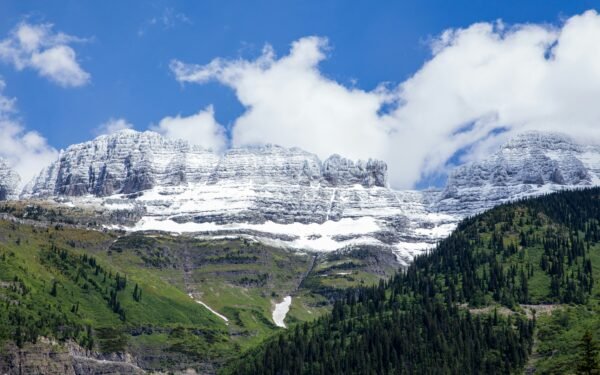
1. Blue Ridge Parkway (North Carolina Section)
Distance: 252 miles | Highest point: 6,053 ft | Season: Year-round (some sections close in winter)
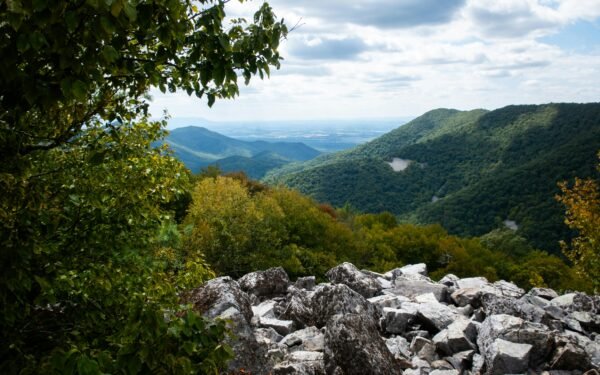
The North Carolina section of the Parkway is where the road reaches its highest and most dramatic. Linn Cove Viaduct at milepost 304 is an engineering marvel — the road curves around the face of Grandfather Mountain on a precast concrete bridge suspended from the cliff. Richland Balsam at milepost 431 is the Parkway’s highest point at 6,053 feet. The Waterrock Knob viewpoint provides 360-degree views of the Great Smoky Mountains on clear days. Asheville sits right along the route and serves as the perfect base for exploring multiple sections.
2. Tail of the Dragon (US 129)
Distance: 11 miles | Season: Year-round
318 curves in 11 miles. The Tail of the Dragon on the North Carolina-Tennessee border is the most famous driving road in the eastern United States. Every curve is numbered and named, and the road has become a pilgrimage for sports car and motorcycle enthusiasts worldwide. A professional photographer at the “Dragon’s Lair” captures every vehicle that passes — you can buy your photo online after the run. The Tree of Shame at Deals Gap displays motorcycle and car parts from crashes, serving as a reminder to respect the road’s limits. Drive within your abilities — the Dragon is unforgiving of mistakes.
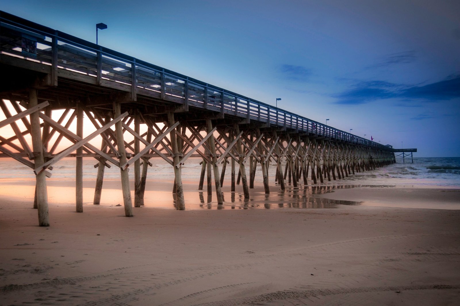
3. Outer Banks Scenic Byway (NC 12)
Distance: 138 miles | Season: Year-round (check for storm closures)
A drive along the narrow barrier islands of North Carolina’s coast, with the Atlantic Ocean on one side and Pamlico Sound on the other. The road connects Nags Head to Ocracoke via a ferry crossing at Hatteras Inlet. Cape Hatteras Lighthouse, the tallest brick lighthouse in America, is the iconic stop. Wild horses roam the beaches near Corolla at the northern end. The drive includes two ferry crossings that are part of the experience — they’re free and give you a chance to stretch your legs on the water. Check road conditions during storm season as sand regularly covers the road.
4. Cherohala Skyway
Distance: 43 miles | Highest point: 5,400 ft | Season: Year-round
Often called the “little brother” of the Blue Ridge Parkway, the Cherohala Skyway crosses the Cherokee and Nantahala National Forests between Robbinsville, NC and Tellico Plains, TN. The road took 34 years to build and cost $100 million, and the result is a smooth, sweeping mountain highway with panoramic views from grassy balds at the summit. Unlike the Tail of the Dragon, the Cherohala is about relaxed cruising rather than aggressive driving. Overlooks at Santeetlah and Hooper Bald provide the best vistas.
5. Grandfather Mountain to Blowing Rock
Distance: 15 miles | Season: Year-round
A short but spectacular drive through the High Country. Grandfather Mountain’s Mile High Swinging Bridge at 5,280 feet is the highest suspension footbridge in America. The attraction charges admission, but the views of layered mountain ridges are worth it. The drive continues to Blowing Rock, a charming mountain village perched on the Blue Ridge escarpment. The namesake Blowing Rock formation has an updraft so strong that snow appears to blow upward. Moses Cone Memorial Park, accessible from the Blue Ridge Parkway, has a beautiful historic mansion and carriage trails.
6. Newfound Gap Road — Great Smoky Mountains
Distance: 33 miles | Season: Year-round
The only road crossing the Great Smoky Mountains National Park from North Carolina to Tennessee. Starting in Cherokee, NC, the road climbs 3,000 feet through old-growth forest to Newfound Gap at 5,046 feet on the state line. Clingmans Dome, the highest point in the Smokies at 6,643 feet, is accessible from a seven-mile spur road. The park is the most visited in the National Park System, so expect traffic — arrive before 8 AM or after 5 PM for a more peaceful experience. No entrance fee.
7. Devil’s Whip (NC 80)
Distance: 20 miles | Season: Year-round
A lesser-known mountain road connecting the Blue Ridge Parkway to the town of Marion. NC 80 drops nearly 3,000 feet in elevation through a series of switchbacks that rival the Tail of the Dragon for intensity but with a fraction of the traffic. The road follows the North Fork of the Catawba River through dense forest. Locals consider it one of the best-kept secret driving roads in western North Carolina. Not recommended for large vehicles or nervous passengers.
8. Waterfall Byway (US 64)
Distance: 25 miles (Highlands to Brevard) | Season: Year-round
Transylvania County is known as the “Land of Waterfalls” with over 250 cascades within its borders. US 64 between Highlands and Brevard passes several of the most accessible ones. Dry Falls lets you walk behind a 65-foot curtain of water. Bridal Veil Falls drops directly over the road — you can drive under it. Whitewater Falls, accessible from a short spur road, is the highest waterfall east of the Rockies at 411 feet. The entire corridor is surrounded by temperate rainforest that receives over 90 inches of rainfall annually.
9. NC 226A — Diamondback
Distance: 12 miles | Season: Year-round
While the Tail of the Dragon gets all the attention, local riders know that NC 226A between the Blue Ridge Parkway and Little Switzerland offers equally exciting curves with significantly fewer vehicles. The road descends from the Parkway through a series of banked curves that feel almost like a racing circuit. The road surface is well-maintained and the gradient is consistent. End the drive at the Switzerland Inn for views of the Piedmont stretching to the horizon.
10. Foothills Parkway — Nantahala Gorge
Distance: 30 miles | Season: Year-round
US 19/74 through the Nantahala Gorge follows the Nantahala River through a narrow, steep-walled canyon. The road shares the gorge with the river and the Great Smoky Mountains Railroad, creating a multi-layered scene of water, rail, and road. The Nantahala Outdoor Center at the gorge’s end is a hub for whitewater rafting — watching rafters tackle the rapids from the road pullouts is entertainment in itself. The gorge is coolest on hot summer days, making it a natural air-conditioned drive.
North Carolina elevation tip: Western North Carolina mountains can be 20-30 degrees cooler than the piedmont cities just an hour away. Asheville at 2,100 feet is noticeably cooler than Charlotte, and the Blue Ridge Parkway above 5,000 feet can feel like a different season entirely. Always pack a jacket even in summer if you’re heading to the high elevations.
Frequently asked questions
Leave a Reply